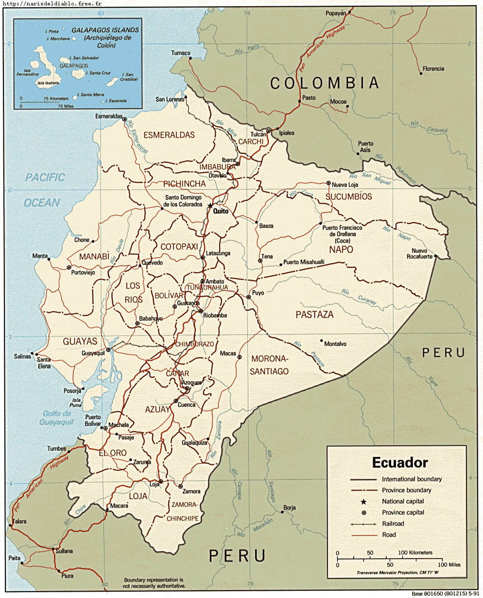


ECUADOR is located on the west coast of South America, bording with COLOMBIA at the north, and PERU at the south. The country size is like the half of France and is crossed by the Andes cordillera where not less than 55 volcanos can be found, some of which are inactive, other in somnolence... and very few completely extinct!
The profile and the layout of the train line will make it possible to locate you during the voyage, as well as to notice the impressionant altitude level changes and also the distances separating each station.
Short after our departure from RIOBAMBA, the TUNGURAHUA volcano greets us with a splendid explosion of ashes. It has been almost a year and a half that this happens. When I came in November 1999, the activity was even more intense, with spouts of lava and more spectacular explosions.
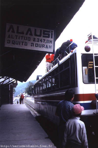
When we departed from RIOBAMBA, it was still dark. For the pictures, this is not the best... that's a pity because it's at this time when the activity of this station is at it's peak. Our first stop is located at CAJABAMBA, and it's when my wife and me decided to go up on the roof of the ferrocarril. The sight is wonderful, but the weather is freezing cold! It is hardly 6 hours in the morning! Brrr!!
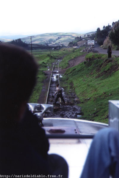
Small problem : the tracks are blocked with the mud that goes up from the ground each time that a train passes. The maintenance of the tracks and the tools available are rather limited, so it's normal having this kind of problems. However it's not quite serious : after 10 minutes we continue our way without any trouble.
Here we are in GUAMOTE, 50 kilometers away from our starting point. We will stop 30 minutes to be in contact with the local population, as well as to drink a coffee or buy something to eat. One can find almost everything to eat, but especially typical food (soup, boiled eggs, grilled bananas, meat with or without home made sauce...).
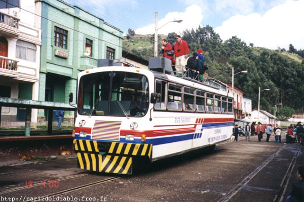
This is the ferrocarril on which we are traveling. At this point the sun finally goes out, but even with this, the temperature is not tropical at all. For so splendid landscapes, we can make some sacrifices...
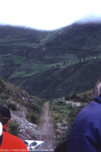
As we climb, the landscape changes... and the layout becomes increasingly sinuous to be able to pass between the mountains.
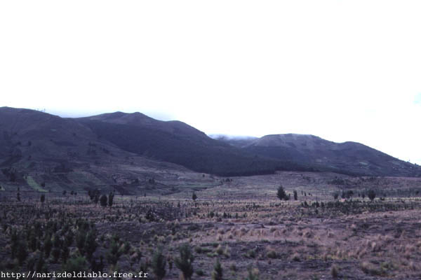
Near PALMIRA, at 3239 meters, the landscape becomes desertic : almost nothing grows. It remains only some conifers and dry grass, it looks like the moon's landscape. Astonishing!!!
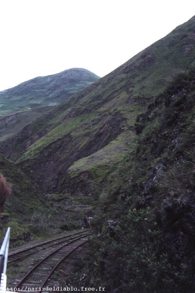
As soon as we go down, the landscape become greener and nicer again. We cross many small villages and every time we risk to crash the animals that live here in complete freedom.
Last pause before starting the descend towards the NARIZ DEL DIABLO, our main goal. We benefit from this stop to eat a little bit : we are affected by the altitude and we need calorific food.
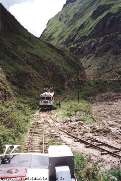
We start again! It's here that the spectacle begins. It's a pity that we have not a lot of sun, but it's already good that it does not rain.
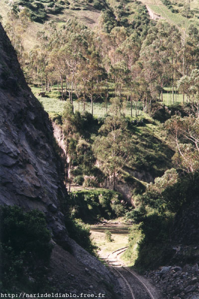
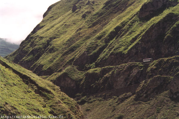
After passing this point, the driver is obliged to move the track's switch and drive back the ferrocarril. This allows to do a zigzag movement, and to go down thru the abrupt precipice. It is only after several operations like these that we will reach the bottom of the valley. It is the unique technical possibility for this difficult topography.
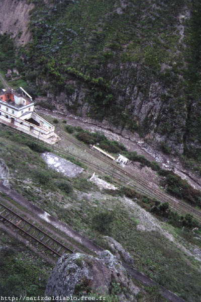
This is our objective! We will have to pass the tracks we see below with two additional movements in zigzag, as explained previously. It is very impressive and scary knowing the conditions of the tracks... and the light weight of the ferrocarril. As the ferrocarril moves along, we cling stronger!
On this picture we can see the ferrocarril which left shortly after us, descending the NARIZ DEL DIABLO. It is only this way that one can realise the altitude and the distances...
Here, we are joined by the other ferrocarril. We will return to ALAUSI, and unfortunately the rest of the trip is not so interesting. Only the regular diesel train continues from this point on, to DURAN.
If this place is named like this, it is because of this mountain. In fact, it is the shape of the mountain and not the railway line that gives the name. Towards the summit of the mountain, the rock looks like an enormous nose. It is thus quite naturally that this place is called "NOSE OF THE DEVIL".
We are getting to the end. It was an extraordinary experience, it is really something which I recommend to see if you ever have the occasion to travel to Ecuador. Do not leave this splendid country without having seen this! It would be a shame.
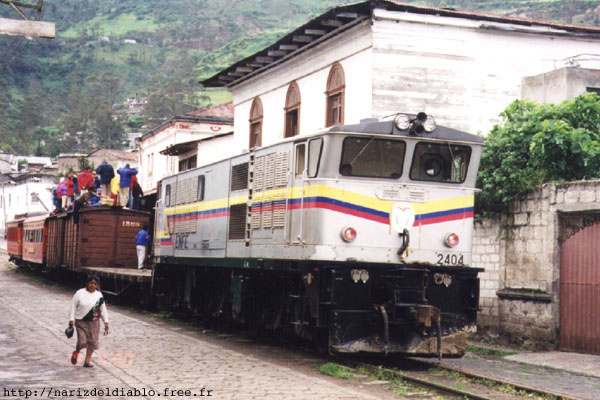
If you want to continue the voyage towards DURAN, you have to take this train, without forgetting, of course, to travel on the roof!